
Description
C-MAP NA-M021 Max N+ microSD
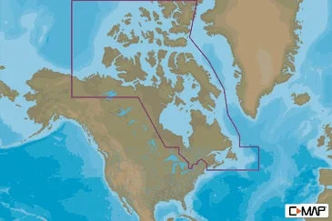
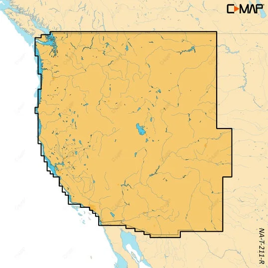
Canada North And East
Model: NA-Y021
- Card Format: SD/MicroSD
- Full-Featured Vector Charts – Provide boaters with the accurate,up-to-date vector chart detail including Depth Areas and Contours, SpotSoundings, NavAids, Light Sectors, Wrecks/Obstructions, Small CraftFacilities and more
- Harbor & Approach Details – Lets boaters approach any harbor and inletwith confidence – the perfect conclusion to a long voyage, sailing adventureor exciting day of bluewater fishing
- Tides & Currents – Presents the time, water level and direction of tideswith Tide Level graphs and indicates predicted current time, direction andstrength of currents with Current Flow graphs and colored arrows. Thisinformation is vital for navigation and fishing
- C-Marina Port Database – Provides useful, categorized information forcruisers, fishermen and sailors – including Port Layout and Facilities,Operating Hours, Accessibility, Phone/Email Contact Info and more
- Detailed Marina Port Plans – Docking in an unfamiliar port is noproblem, when you have precise layouts of thousands of marinas, includingslip spaces, restricted areas, and other valuable navigation information
- Dynamic Raster – Traditional “”paper chart”” look with unique ability toaccess information on buoys, lights and other details
- Satellite – High-resolution satellite imagery provides real-worldreference, enhances situational awareness for coastal navigation
- High Resolution Bathy Data – The highest available detail of underwaterpinnacles, ledges and canyons that are magnets for offshore and coastalgamefish
- Sport Fishing Data – Provides angling intelligence for wrecks and reefs,Fish ID photos, fishing tips, updated regulations, state records and more
- Aerial Photos – High-Definition Photos & Diagrams of ports, marinas andsignificant navigational marks
- Custom Shaded Depths – Shaded depths make it easy to distinguishdifferent water depths
- Multi-Language – Display charts in both English and one of 19 locallanguages currently available
MAX-N+ brings all the popular C-MAP 4D features to the the Navico family ofchartplotters, including: Detailed Harbor Charts, Dynamic RasterCharts,High-Resolution Satellite Imagery, Custom Shaded Depths, DynamicTides &Currents, High-Resolution Bathymetric Data, Sport Fishing Data,Aerial Photos, C-Marina Port Info & Multi-Language Charts.
C-MAP MAX-N+ brings trusted Jeppesen data and advanced charting features tousers of compatible Lowrance, Simrad and B&G navigation systems.
Whether you’re an avid saltwater angler, sailing enthusiast or long-rangecruiser, these powerful charts will enhance every moment you spend on thewater. With huge coverage areas, up-to-date data and state-of-the-artfeatures, no adventure is out of reach.
Specifications
| Card Format | MicroSD/SD |
| Port Plans | Yes |
| Dimensions | 1″”H x 6″”W x 10″”L WT: 0.1 lbs |
Reviews
There are no reviews yet.