
Description
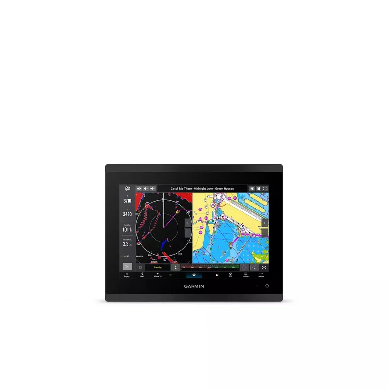
GPSMAP® 9010 is the integrated touchscreen chartplotter designed for captains who demand the best. Enjoy edge-to-edge clarity with a high-resolution display on a glass helm with premium design and materials. Plot your paradise faster than ever with processing power that’s up to 7 times faster than previous generations, and get 5GHz Wi-Fi® connectivity for ActiveCaptain® app updates. Get a connected boating experience by linking your compatible MFDs, cameras, sonars and more on the gigabit-speed Garmin BlueNet™ network. The full suite of Garmin SailAssist™ features allows you to see wind speed, direction and other critical data at a glance. When your hands are full, use spoken commands to operate the chartplotter (compatible headset or smartwatch required; not included). Navigate on the water with support for Garmin Navionics+™ charts, or upgrade to premium Garmin Navionics Vision+™ charts. Garmin Navionics+ includes a 1-year subscription for daily chart updates and support for Auto Guidance+™ technology, which helps you navigate and avoid land- and water-based obstacles based on chart data (for planning purposes only and does not replace safe navigation operations).
Includes:
- Chartplotter
- MicroSD™ preinstalled
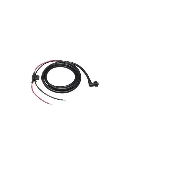
- Power cable
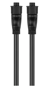
- 2-meter backbone/drop cable and T-connector for the NMEA 2000® network
- Flush mount kit
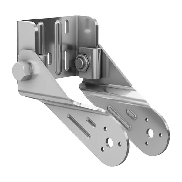
- Bail mount
- Protective cover and documentation
- 10″ model features full HD display
- Glass helm with edge-to-edge design for seamless and modern look
- Processing power is up to 7 times faster than previous generations for superior performance, plus get faster wireless ActiveCaptain® app transfer speeds with 5GHz Wi-Fi® connectivity.
- Enjoy premium sailing features, such as sailing polars, plus see laylines, race start line guidance and more with Garmin SailAssist™ features.
- Build extensive networks with reliable connectivity and gigabit speeds on the Garmin BlueNet™ network.
- Enjoy high-quality entertainment with video integration capabilities with HDCP distribution.
- Uses the NMEA 2000® and NMEA 0183® networks to connect to your compatible autopilots, sensors and more; compatible with existing marine ecosystems.
- Take command of monitoring, control and automation systems with support for the EmpirBus™ system and other third-party solutions via OneHelm™ integrated digital switching.
- Keep tabs on engine performance with extensive engine integration, including SAE J1939 connectivity and a wide range of support for outboard engine manufacturers.
- Support for Garmin Navionics+™ charts with Auto Guidance+™ technology (for planning purposes only and does not replace safe navigation operations) and Garmin Navionics Vision+™ charts with premium features such as high-resolution relief shading.
- Connect your compatible Garmin devices and more with integrated BLUETOOTH® and ANT® technologies; use spoken commands to control the chartplotter with your compatible headset or Garmin smartwatch.
- Built for harsh marine conditions with an IPX7 water-resistance rating.
Specs
- UPC: 753759343460
- Dimension: 10.24″ x 7.87″ x 3.54″ (26 cm x 20 cm x 9.1 cm)
- Weight: 5.55 lbs (2.52 kg)
- Water Rating: IPX7
- Touchscreen: Yes
- Display Type: WUXGA, IPS; Edge Lit backlight
- Display Size: 8.54″ x 5.34″ x 10.1″ diagonal (21.7 cm x 13.6 cm x 25.6 cm diagonal)
- DISPLAY RESOLUTION: 1920 x 1200 pixels
- Mounting Options: Bail, flat or flush
- Input: Touchscreen
- Polarized Lens Viewability: Yes
- Accepts Data Cards: 2 microSD™ cards (on rear of product)
- Waypoints: 5,000
- Track Points: 50,000
- Tracks: 50 saved tracks
- Navigation Routes: 100
- GPS sensor: Yes
- GLONASS Sensor: Yes
- Galileo Sensor: Yes
- BeiDou Sensor: Yes
- Has built-in receiver: Yes
- Receiver: 10 Hz
- NMEA 2000 Compatible: Yes
- NMEA 0183 Compatible: Yes
- Supports WAAS: Yes
- Supports Multi-Band, Multi-Constellation GPS: Yes
- Optional BlueChart g3 Map

Reviews
There are no reviews yet.